Location and key features
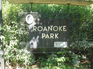 Roanoke Park is one of the original "pods" in Kansas City's historic Parks and Boulevards system, as designed by George E. Kessler. It was referred to as "Roanoke Park" as early as 1904, officially becoming a park on January 13, 1909.1 (The two largest donations of land for the park occurred in 1901 and 1905, with smaller parcels being added up through 1923.) It lies in a wooded ravine surrounded by rocky bluffs. Atop the bluffs sit the historic homes of some of Kansas City's most beautiful neighborhoods: Coleman Highlands to the north, Roanoke and Valentine to the south and east and Volker to the west. The park is roughly centered on the intersection of Karnes and Roanoke Rd. in Kansas City, Missouri. This Google Street View will allow you to pan around that intersection, as it appeared before park volunteers started cutting back the honeysuckle. Click on the timeline in the corner and select a date: Roanoke Rd & Karnes Blvd...
See http://kcparks.org/park/roanoke-park/ for a detailed history, location map and photo gallery.
The distinctive rocky bluffs encircling the park are Iola limestone sitting atop Chanute shale. (Kansas City's famous Bethany Falls limestone lies many feet underground below the park.) According to the park board report of 1907, "This property should be held as a bit of wilderness, which is now its charm, and which would be entirely lost if attempts were made to finely finish any part of this valley...In the old quarry west of Roanoke Ave. and north of 38th St., the very fine spring there should be developed; a pool and a modest water garden." While the wading pool of years past is no longer in existance, the Coleman Highlands Spring currently flows down the hillside north of Karnes. A wide variety of plants can be found in the park, from trees, shrubs and flowers, to ferns, mosses and lichens covering the rocks. As the park is restored for the future, many more will be planted and be given room to grow by the removal of non-native invasive species.
There is a ball diamond across from the community center, a soccer field north of the community center and tennis courts southwest of the community center. East of the tennis courts is one the the park's two playgrounds. All new playground equipment was installed in 2014. The other is east of Karnes Blvd, between Madison and 35th Street. An extensive re-envisioning of that playground is ongoing. A sand volleyball court is just east of the intersection of Karnes and Roanoke and was also completely renewed in 2014. Many walking paths and sidewalks wind through the park including a network of singletrack hiking/biking trails.
Click here for a map of the trails: Roanoke_Park_Trails.pdf
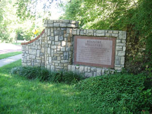 The brick paved section of Roanoke Boulevard between Valentine and Karnes is one of the few remaining brick roads in Kansas City and has been designated a historic landmark.There was once a cave in the park. You can see where the entrance was walled up if you know where to look. The Roanoke Neighborhood site has an excellent page on the cave mystery.
Roanoke Park covers 37.59 acres and has 1.34 miles of roadway within it.2 Additionally, the boulevards of Roanoke Boulevard, Karnes Boulevard and Valentine Road feed into the park.
Westport-Roanoke Community Center
The community center is a wonderful neighborhood resource, offering meeting spaces and a variety of arts and fitness opportunities. Learn more at http://kcparks.org/facility/westport-roanoke-community-center/
1http://kcparks.org/park/roanoke-park/
2Kansas City, Missouri Parks and Recreation, 2009 Reference Book